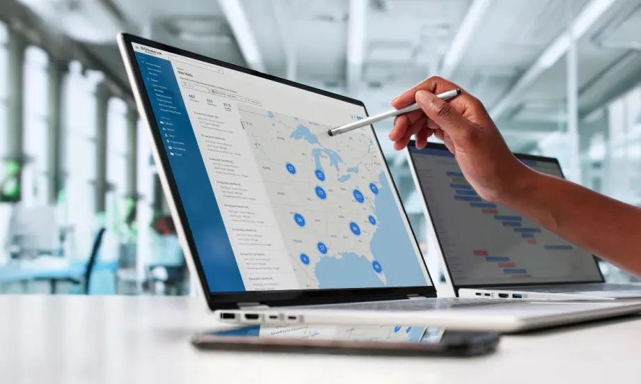
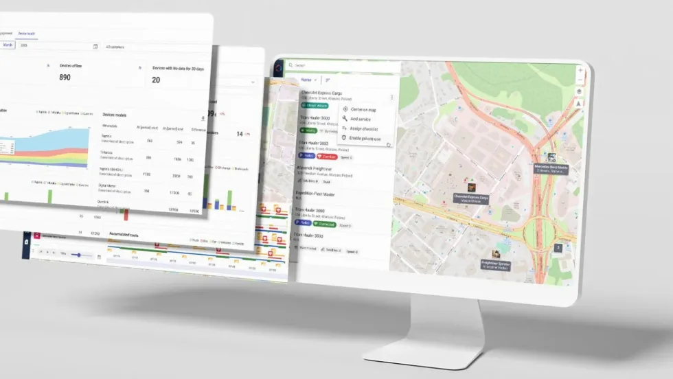
Fleet managers gain real-time visibility into safety events with Drivewyze Safety+ Map View, helping identify risks and improve coaching across regions.
Photo: Fleetworthy
4 min to read
Fleetworthy launched two advancements within Drivewyze by Fleetworthy. For Drivewyze’s Safety+ product, a new Site Visits Map View offers map visualization across various safety fronts. Additionally, for the company’s weigh station bypass service, a new PreClear Savings Overview Report provides insights into real ROI savings and opportunities for further savings.
Ad Loading...
“Both enhancements support the mission of providing customers with actionable insights to make better decisions,” said Martin Murtland, VP of Product at Fleetworthy. “Our new Map View for Safety+ gives an instant snapshot as to what’s happening in a variety of risk areas, so decisions and risk-management coaching can take place immediately. For our weigh station bypass customers, our new reporting tool gives clear data on the ROI of the service.”
Ad Loading...
Safety+ Site Visits Map View Provides a New Lens on Safety Performance
Through Safety+, drivers receive proactive location-based in-cab safety alerts about potential safety risks ahead. Alerts include severe weather, high-citation speeding zones, cargo theft hotspots, high-rollover areas, low bridges, state-sponsored sudden slowdowns, and more.
Safety+ helps reduce costs and improve driver awareness by allowing fleets to create their own geo-fenced custom zones to:
Highlight safety hotspots.
Reinforce policies such as terminal reminders.
Warn about predatory parking locations.
Safety+ Site Visits Map View can transform how fleets monitor and respond to risk by plotting safety events on an interactive map in the Drivewyze Hub portal.
“Fleets can filter safety events by type, severity, date range, and more to focus on specific concerns,” Murtland said.
Ad Loading...
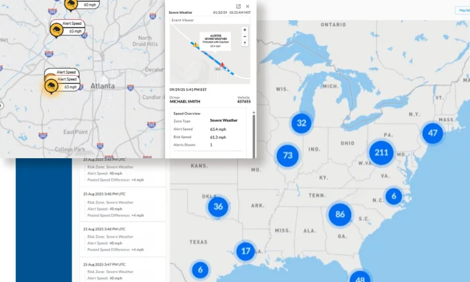
For example, by overlaying severe National Weather Service (NWS) alerts with the location of a fleet’s trucks and Safety+ data, managers can gain an integrated view of operating conditions without needing to switch between multiple sources and platforms. Managers can immediately see which drivers are in affected zones and take action to minimize exposure and delays.
“Fleet managers can then visually see which trucks are encountering or will encounter bad conditions, such as heavy snow, icy conditions, or local flooding, and act on it in a timely fashion,” said Murtland. “Drivers are alerted to these approaching risks to keep them safer. Based on customer feedback, if a driver is then in severe weather and not driving appropriately for those conditions, they are sent a second in-cab alert. It’s like having a safety trainer in the cab, but only when needed.”
Through Site Visit Map View, safety managers can also quickly identify which drivers require additional coaching and in what areas. What’s more, they can see the precise location helping uncover potential patterns within a state or region, for example.
“Combined, these geographic visualizations highlight clusters of events, allowing fleets to quickly pinpoint at-risk drivers, identify patterns, and target coaching,” added Murtland. “Site Visits Map View helps fleets move from reactive reporting to proactive risk management.”
Key features include:
Ad Loading...
Geographical insights at a glance: Quickly identify which trucks and drivers are most at risk when driving in proximity to severe weather.
Smart filters: Personalize what risks to focus on, whether it is severity, risk event type, or date range, using intuitive filters.
Enhanced coaching: Pinpoint critical coachable moments for higher risk drivers using configurable speed thresholds to enable meaningful conversations based on evidence and data-driven insights.
Drivewyze Safety+ highlights severe weather alerts and driver speeds, giving fleets location-based insights to act quickly and coach drivers effectively.
Photo: Fleetworthy
Drivewyze PreClear Savings Interaction Dashboard
Fleetworthy has also introduced the Drivewyze PreClear Savings Overview Report, a new interactive dashboard in Drivewyze Hub that helps customers calculate the real and potential return on investment from bypassing weigh stations.
Drivewyze PreClear, the largest weigh station bypass network in North America, helps fleets avoid unnecessary pull-ins and inspections at 925 locations. The new Savings Overview Report highlights the financial and operational benefits of bypasses by measuring the ROI from savings on time, fuel, and carbon dioxide emissions.
The interactive map and charts provide insights into coverage across North America and how the fleet can improve its bypass savings.
“By making bypass ROI transparent, we’re empowering fleets to optimize operations and savings,” said Murtland. “The Savings Overview Report demonstrates the measurable impact Drivewyze PreClear has on the bottom line, reinforcing the case for broader adoption across fleets of all sizes.”
For service fleets, missing tools and equipment can lead to second trips, lost technician time, higher operating costs, and delayed jobs. Equipment tracking can help HVAC, plumbing, electrical, landscaping, and other service businesses improve visibility and reduce downtime.
Geofencing is a familiar fleet tool today, but its early adoption marked a major shift in vehicle tracking, route monitoring, and the debate over employee privacy.
Geotab's first U.S. supply chain report finds stable long-haul activity, stronger regional freight movement, tighter hub-and-spoke utilization, and more last-mile trips on shorter routes.
New technology can help fleets work smarter, but only if it solves the right problem. Lauren Fletcher talks with AP Fleet’s Alex Coveney about innovation, AI, data, and knowing when a new solution is actually worth adopting.
Unattended over-the-air software updates are now available in Volvo trucks across the U.S. and Canada. The new capability lets trucks stay current with the latest software without interrupting operations or requiring a dealership visit.
GM's new pickup interface puts trailering data, camera views, vehicle controls, and smartphone integration closer to the driver in the 2027 Silverado and Sierra.
Samsara’s new driver rewards program was built with a broader professional driver in mind, including employees who split their day between driving, job sites, service calls, and other work.
Verra Mobility has launched a new AI-driven Title & Registration platform to help fleets move vehicles from acquisition to the road the same day while reducing compliance risk.
Wialon has introduced hardware-free OEM integration as the EU Data Act accelerates the shift in vehicle data access across the fleet industry in many countries.